I had a few suggestions as to how to improve the map. Changing the size of the system symbol to give a more 3D effect, changing lines for the different jump routes and what drawing package I used. I will answer the last question first. I used a freeware package called PAINT.net. It is a souped up MS Paint that allows the use of layers. In the maps below there are different layers for the background, the grid, systems, system names and jump route.
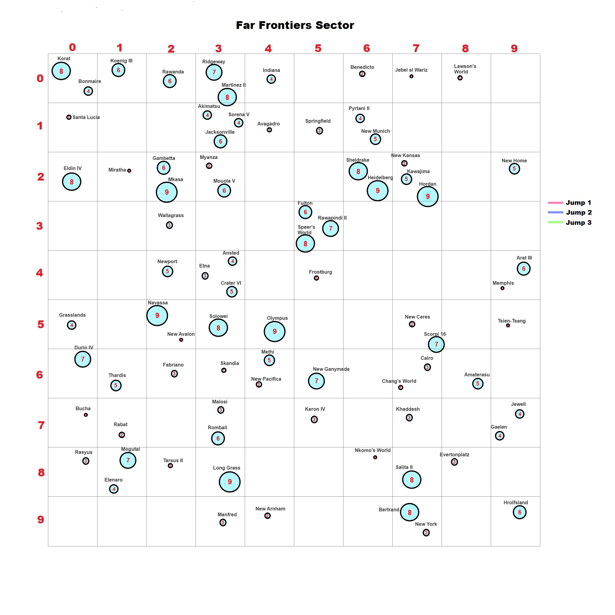
So, here is the Map Mk11. First off, a map with no Jump Routes shown.
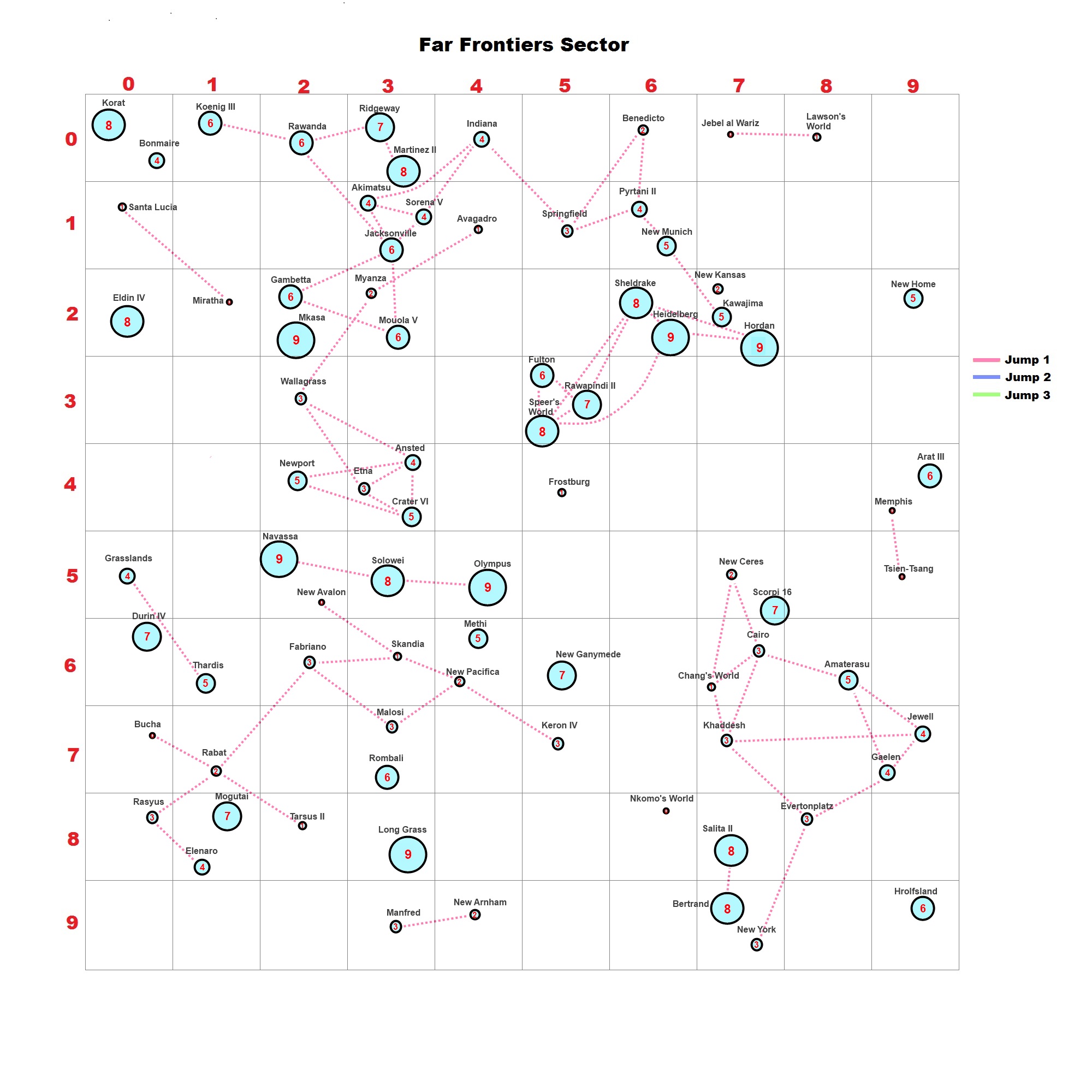
The next map shows Jump 1 routes. There are three clusters of systems that are Jump1 apart – mini-Mains as it were.
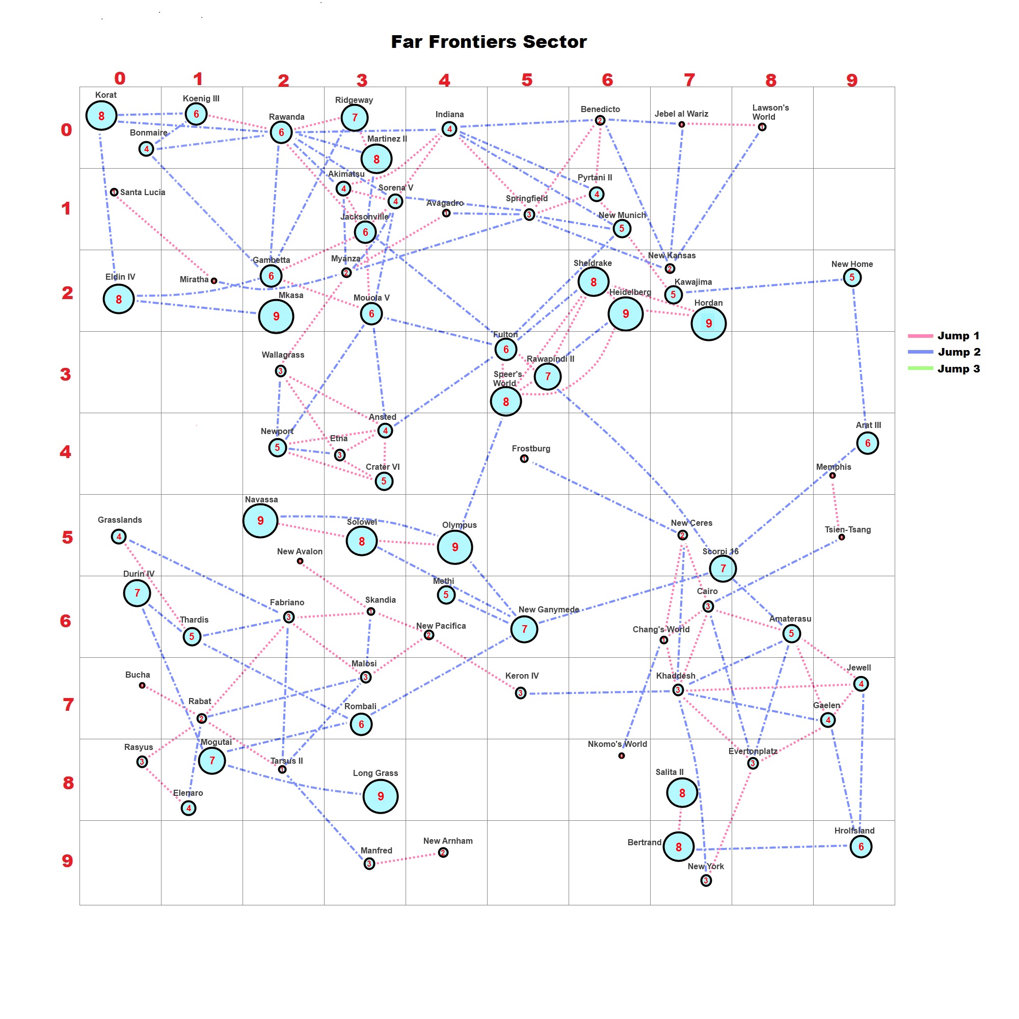
When the Jump 2 routes are added every system in the Sector is reachable. While typing I noticed two more J2 links I missed. No wonder the Vilani forbade the secret of the Jump2 drive from subject races.
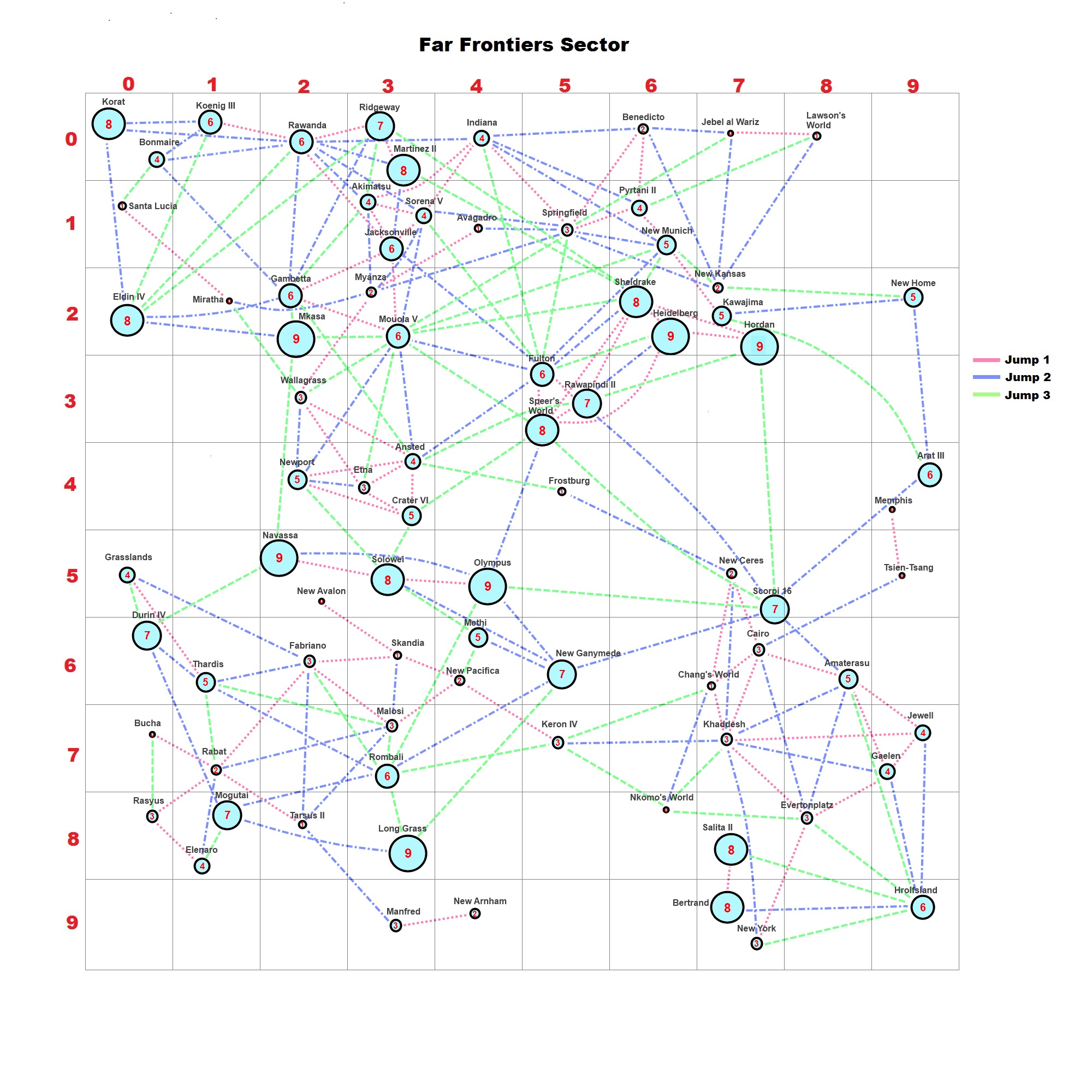
When you add the Jump3 (and higher) Routes, the speed of communication and travel opens the Subsector up.
I hope you like these changes and perhaps can see a use for them if you give 3D mapping a go for your own Traveller games.


Leave a comment